|
||||||||||
 |
 |
||||
|
TOWNS & VILLAGES Balnarring & Surrounds Blairgowrie Dromana Flinders & Surrounds Frankston & Surrounds French Island Hastings & Surrounds Mornington & Surrounds Mount Eliza Mount Martha Red Hill & Surrounds Rosebud & Surrounds Rosebud West Rye & Surrounds Safety Beach & Hidden Harbour Sorrento & Portsea Tyabb & Surrounds ACCOMMODATION Bed & Breakfast Caravan & Holiday Parks Hotels & Motels Pets Welcome Self Contained & Other Booking Services ATTRACTIONS Antiques & Collectables Beaches Boat Hire & Jet Ski Hire Day Spas & Hot Springs Dolphin & Seal Swims Fishing Galleries Golf Historical Homes & Gardens Horse Riding Markets & Fairs Museums Tours Walks Parks & Wildlife Water Activities Wineries Winery Tours Other FOOD & DINING Cafe's Restaurants Healthy Food Fast Food ENTERTAINMENT Cinemas & Theatres Clubs Pubs Nightclubs Other SHOPPING Go to Shopping Index SERVICES Go to Business Services Index CHI Travel Insurance
TRAVEL SITES
|
Historical Facts - Mornington Peninsula
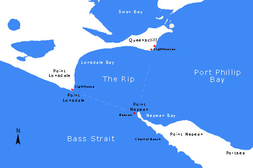
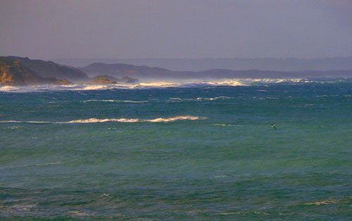
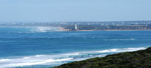
"The Rip" is a dangerous streach of water in Victoria, Australia connecting Port Phillip and Bass Strait. Due to large tidal flows through the relatively narrow channel from the bay to the ocean, and a high rocky seabed, The Rip has claimed many ships and lives. Geographically, it is roughly the triangular area of water between the land points of Point Nepean, Shortlands Bluff and Point Lonsdale, known as the heads. It is the only entrance for shipping into Port Phillip and hence into Melbourne. The rip is generally considered to be located in the triangular area of water between the land points of Point Nepean, Shortlands Bluff and Point Lonsdale. The entrance between Point Lonsdale and Point Nepean is 3.5km wide but the reefs projecting from these points reduce the navigable width to about 1km. Within 800m outside the Heads, there is a shallow rocky flat known as the Rip Bank. The water deepens outside this flat to 30m and inside the Heads to as much as 90m. This inequality of depth combined with tidal streams running up to 6 knots, causes world-renowned dangerous conditions. The variation in seafloor depth within the rip itself can be anywhere from 50m to less than 5m amongst the rocky reefs and shoals.
Entering the heads of Port Phillip is a risky and dangerous procedure. Many sailors regard it as one of the most dangerous shipping paths in the world. Large ships may only enter Port Phillip with a qualified pilot aboard to help them navigate through the heads. The heads are very narrow, having a width of approximately two kilometres. When entering, large ships have to follow a precise S-shaped course through the heads.
Before the availability of Global Positioning Systems, many sailors used the two historical lighthouses on Queenscliff as a guide to get into the bay without hitting bedrock. A feature of the pair of lighthouses is that one is black and the other is white. The idea behind this is so that sailors, when using the lighthouses as a guide to get into the heads, can tell the two lighthouses apart and avoid confusion that could lead to disaster. Copyright (c) 2009. Permission is granted to copy, distribute and/or modify this document under the terms of the GNU Free Documentation License, Version 1.2 or any later version published by the Free Software Foundation |
| CONTACT US | ADVERTISE WITH US | LIST YOUR EVENT | ABOUT THIS SITE | TERMS & CONDITIONS | PRIVACY POLICY | SITEMAP | |
DISCLAIMER | |||||||